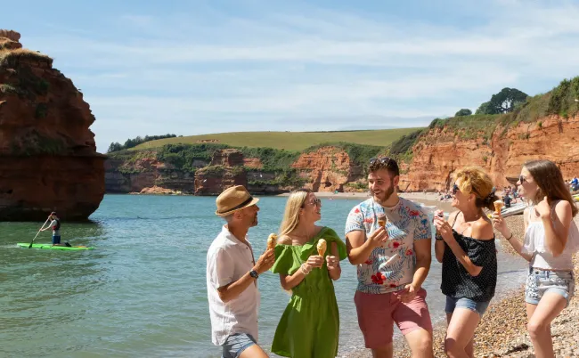
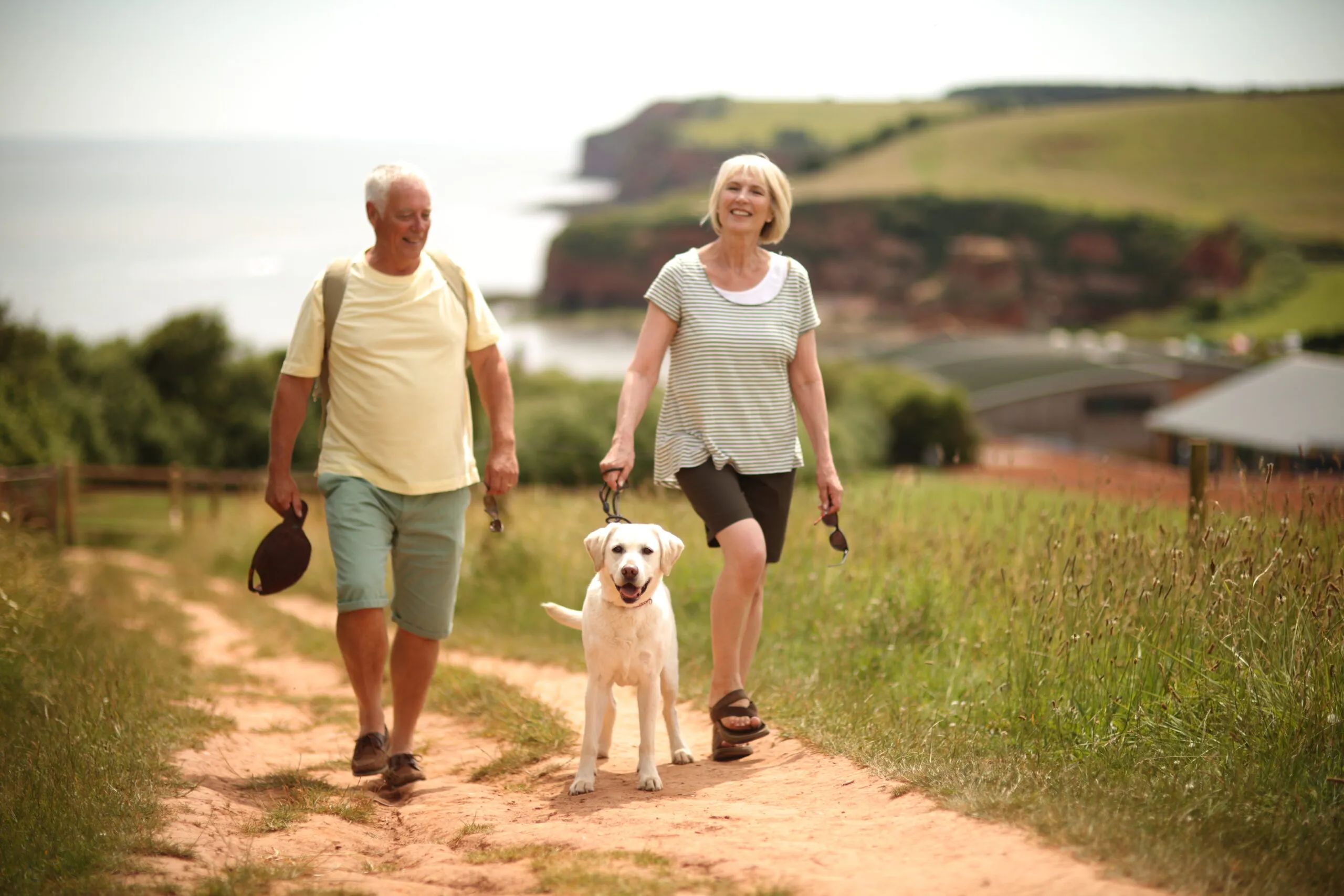
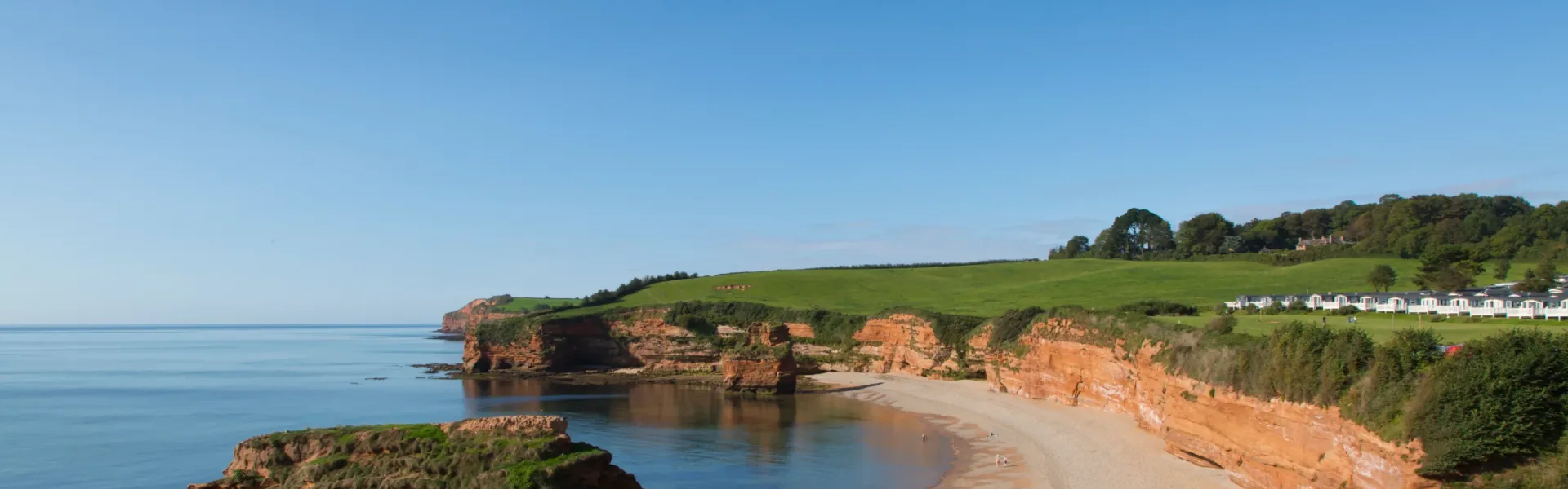
Devon, with its picturesque landscapes, rugged coastline, and charming villages, is a perfect destination for dog owners seeking a dog friendly holiday in Devon. At Ladram Bay Holiday Park, we understand the joy of traveling with pets, and we’re here to guide you through the best dog-friendly attractions in Devon. So, pack your bags, leash up your furry friend, and let’s embark on a memorable journey together!
Devon’s Dog-Friendly Beaches:
Exmouth Beach: Our first stop is Exmouth Beach, known for its long stretches of golden sands and stunning views. Dogs are welcome on certain sections all year round, making it an ideal spot for a seaside stroll or a game of fetch.
Dawlish Warren Beach: Dawlish Warren Beach offers a unique blend of sandy shores and picturesque sand dunes. Dogs are permitted on the beach between October and April, so your canine companion can enjoy some off-leash fun.
Nature Retreats:
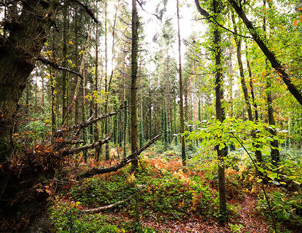
Haldon Forest Park: Explore the enchanting woodlands of Haldon Forest Park, where dogs are welcome on designated trails. With various walking routes to choose from, you and your furry friend can lose yourselves in the beauty of nature.
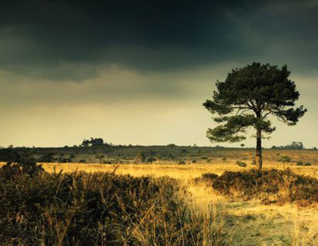
Dartmoor National Park: Dartmoor National Park is a haven for hikers and nature lovers. While dogs must be kept on leads in certain areas, there are plenty of paths and open spaces where they can roam freely.
Historical Adventures:
Powderham Castle: Discover the rich history of Powderham Castle while strolling through its beautiful gardens. Well-behaved dogs on leads are welcome to join you as you explore this historic gem.
Dining Out with Your Pooch:
Dog-Friendly Pubs:
Devon is home to numerous dog-friendly pubs that offer delicious meals for you and a water bowl for your furry friend. Try the local cuisine and enjoy a warm, welcoming atmosphere.
Plan Your Devon Adventure:
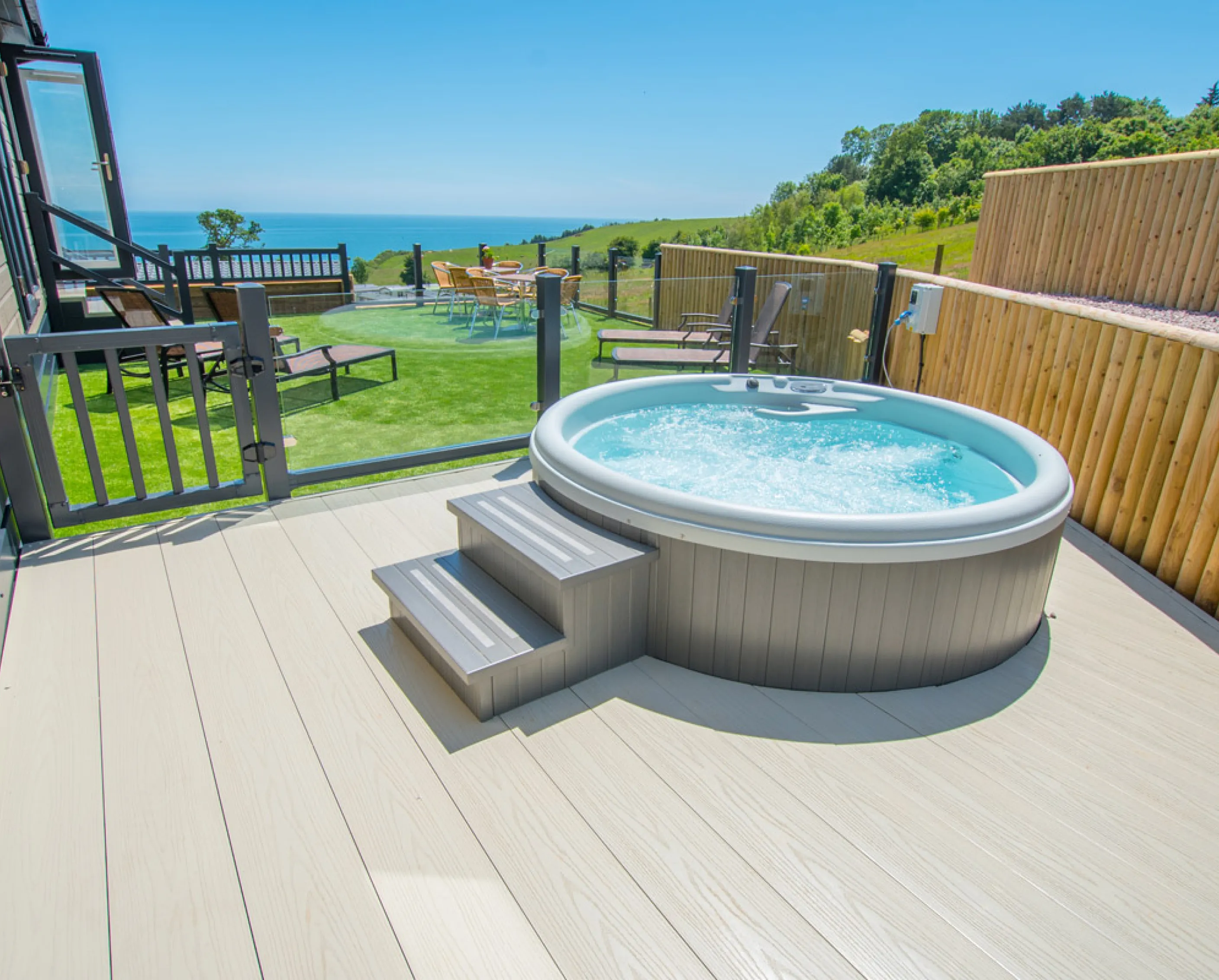
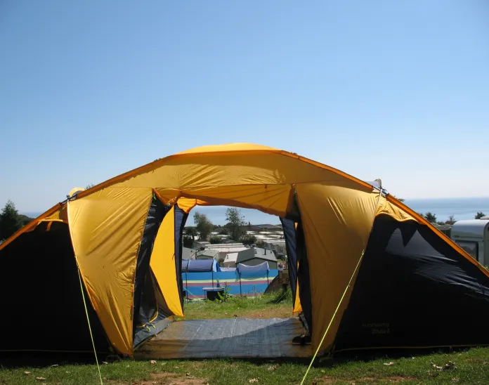
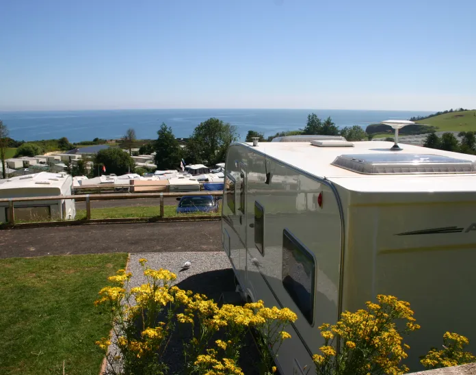
When planning your next dog friendly holiday Devon, consider staying at Ladram Bay Holiday Park. Our pet-friendly accommodations and stunning coastal location make us the perfect base for your Devon adventures. Whether it’s relaxing in one of our lodges or camping under the stars, we have options to suit every preference.
Don’t forget to pack your dog’s essentials, including their leash, food, and water bowls. And always be a responsible pet owner by cleaning up after your dog and respecting local regulations.
Devon’s dog-friendly attractions offer a wealth of experiences for both you and your beloved pet. With its beautiful beaches, scenic trails, and warm hospitality, Devon promises an unforgettable adventure for you and your furry companion. So, embrace the freedom of the great outdoors, explore historic sites, and create lasting memories in this captivating region of the UK.
If you have any questions or need more information about planning your dog-friendly holiday in Devon, Ladram Bay Holiday Park is here to assist you. Contact us today, and let’s make your Devon adventure a reality.
Exploring Devon – A Dog-Friendly Adventure
Our latest post highlights the benefits of Holiday Home Ownership in the UK.
Obviously we’re going to be (a little) biased for this one but for those of you who may never have considered Holiday Home Ownership it’s a pretty compelling argument.
1. Having a hassle-free holiday
Nobody likes being stuck in crowded or overpriced airports, putting up with cancelled flights or unsuitable accommodation. The small details such as overseas insurance, transfers or setting aside holiday money can soon add up to become more hassle in our busy lives. Luckily, if you have a Holiday Home in the UK, you won’t have to put up with any of it. Once you’ve bought the home, that stress can all be a thing of the past.
2. Time in a great location
There’s nothing better than spending time in an area you love, exploring the culture, activities, food and attractions, going for long walks or even just pottering about.
3. Holidays on demand
A Holiday Home is yours to use at any time when you so choose, and if you buy somewhere closer to home a last minute escape is always an option.
4. Your escape, your way
When you have a Holiday Home of your own, there’s no need to constantly bring all of your stuff back and forth each time you want to have a break and you can personalise your space to suit your tastes. Spend less time packing and more time relaxing. Everything is right where you left it.
5. Time with the family
Buying a Holiday Home is an investment in your family, not just a financial investment. Giving your family fond memories of time spent with each other is priceless.
6. The dog can come with you
If you have a Holiday Home in the UK it’s easy to take the dog, so none of the family have to be left behind. We allow Owners to bring up to 2 dogs per visit.
7. De-stressing is good for you
The perfect time to unwind and de-stress is while you’re on a holiday, away from the problems of daily life. If you stay in the UK, you don’t need to worry about aspects of local life and travel you’re unfamiliar with, and potentially there’s less to go wrong. Avoid stress and stay in the UK.
8 Have a tech-break
It’s hard to put phones down and turn the TV off at home, but when you arrive at your Holiday Home it can be your conscious choice to detox from technology, if you want it to be.
9. An investment opportunity
If you’re happy to sublet, you could consider the subletting scheme offered by Ladram Bay Holiday Park. The remuneration made from this scheme can certainly help pay toward your site fees and annual expenses.
10. Treat yourself
Most of us occasionally also need a little space from time to time, to rest, recharge our batteries and return to our jobs and families healthy, happy and energised. Having you own escape in case you need a bit of peace and quiet can keep you in better shape both mentally and physically so it’s not necessarily totally indulgent, it’s common sense too.
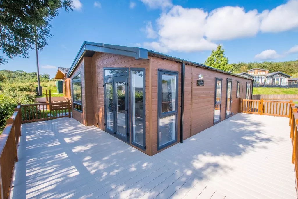
Considering Holiday Home Ownership at Ladram Bay Holiday Park? We’ve a sensational selection of Brand new and Pre-loved Holiday Homes waiting for your perusal. Simply pop into our Sales Showground or call our friendly team on 01395 568761 to book your park tour. We look forward to welcoming you to our fabulous 5-star park.
10 Reasons to buy a Holiday Home
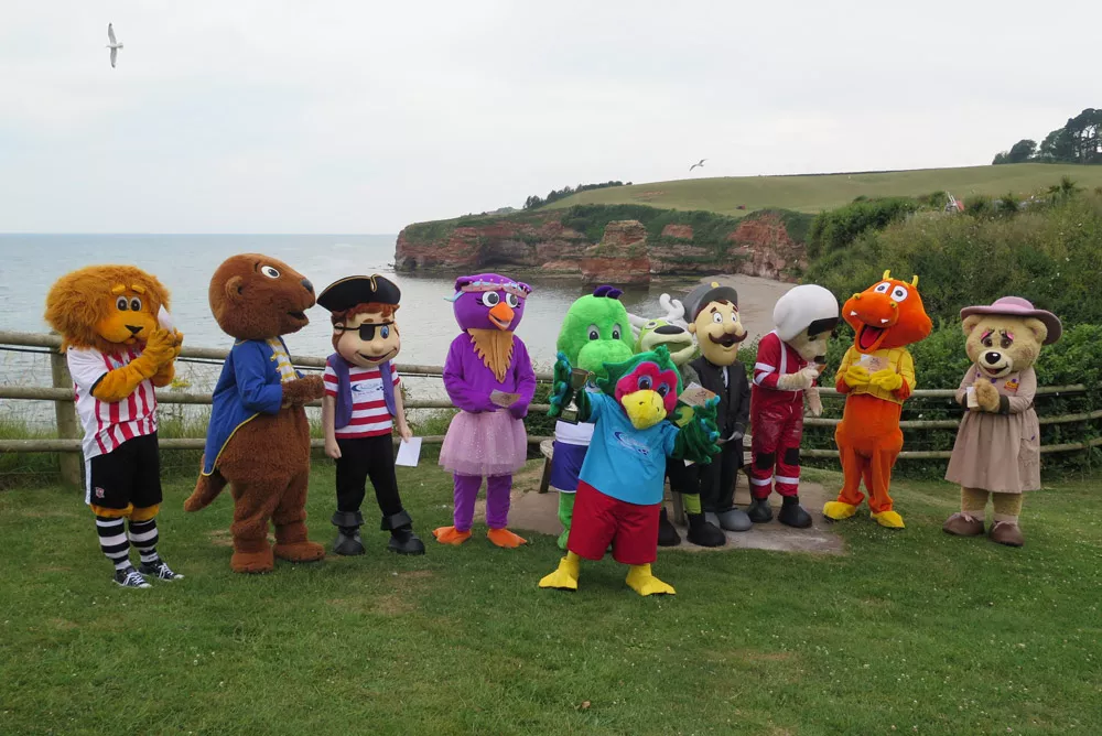
On Wednesday 17th July 2019 Mascots from across Devon participated in the annual Adventure Golf championship.
Prior to Shane Lowry’s success at the Royal Portrush on Sunday, the golfing world’s attention was focused Ladram Bay – it just wasn’t picked up mainstream media. Many in the club house (also known as the swimming pool complex) were calling this the unofficial 5th major of the year & looking at the team lineups it was easy to see why.
Our player guide certainly demonstrates the stiff competition Pickles, Ozzie & Captain Scratch were up against.
With so many plots & sub-plots, a riveting narrative surrounded the 2019 event, held one one of Devon’s most famous links course. Could Crealy’s Blossom Bear emulate the form Buddy the Bear, which had seen him win in 2016 & 2017, or would Gilbert the Station Master become only the second entrant (after Buddy the Bear) to win back-to-back tournaments?
Being super profession partiality was required on our behalf, but only the most partisan fan would begrudge ‘Appy Angus a victory – having finished on the podium in 2016 (3nd) & 2nd in 2017 & 2018.
The Winner: Pickles the Parrot
Pickles the Parrot celebrates with the other 10 mascots overlooking Ladram Bay
A tense opening round saw little to separate the leading group. The smart money had been on the players with big tournament experience, but as it transpired Pickles the Parrot held his nerve to clinch his first Mascot Golf Championship. In second place was Ella the Owl, who held off a late charge from Captain Scratch. The Ladram Bay mascots are ultimately thrilled with their performance, having beaten the previous best showing of 3rd in 2018 (tied with Pippa Pig from Pennywell Farm).
Mascot Golf 2019: Image Gallery
Player guide
Pickles the Parrot greeting fans at the tee off.
Pickles the Parrot
Representing: Ladram Bay
Previous form guide: Group stage exit 2016
2019 Result: 1st
Consistent short game form Ella the Owl
Ella the Owl
Representing: Hospiscare
Previous form guide: New entrant for 2019
2019 Result: 2nd
Captain Scratch in the zone
Captain Scratch
Representing: Ladram Bay
Previous form guide: Group stage exit 2018
2019 Result: 3rd
Ozzie looks to build on his 3rd in 2018
Ozzie the Otter
Representing: Ladram Bay
Previous form guide: 3rd in 2018 (tied with Pippa Pig)
2019 Result: Group stage exit
Grecian the Lion silencing an Argyle fan
Grecian the Lion
Representing: Exeter City Football Club
Previous form guide: Group stage exit 2017
2019 Result: Group stage exit
Buddy the Bear celebrates with the fans
Blossom Bear
Representing: Crealy
Previous form guide: New entrant for 2019.
2019 Result: Group stage exit
‘Appy Angus offering advice on the 5th
‘Appy Angus
Representing: World of Country Life
Previous form guide: 2nd in 2018, 2nd in 2017 & 3rd 2016
2019 Result: Group stage exit
2018 winner Gilbert the Station Master
Gilbert the Station Master
Representing: Seaton Tramway
Previous form guide: 1st in 2018
2019 Result: Group stage exit
The Dragon gets fired up at the 3rd hole
The Dragon
Representing: Pete’s Dragon
Previous form guide: Group stage exit 2018
2019 Result: Group stage exit
Ambrose the Bear putting in it
Ambrose the Bear
Representing: Devon Air Ambulance
Previous form guide: Group stage exit 2016
2019 Result: Group stage exit
Ledley tee’s off with a putter
Ledley
Representing: LED Leisure
Previous form guide: Group stage exit 2016
2019 Result: Group stage exit
Mascots Golf Championship 2019
In recent years we’ve made several new additions to our beach facilities aimed at pleasing kids & big kids alike. So if you’re new to Ladram Bay or haven’t visited in several years, the following post covers things to do whilst on the beach, allowing you to make the most of your family getaway.
You’ve just arrived at Ladram Bay, checked-in, ticked off the essentials shopping list & got your uniform inflatable primed. Firstly take a minute to appreciate your amazing parenting skills & then think about your next port of call, the beach.
Use the bullet points (below) to navigate directly to a particular beach based activity. Should it take your fancy, simply click on it to skip to that section.
Paddle board hire
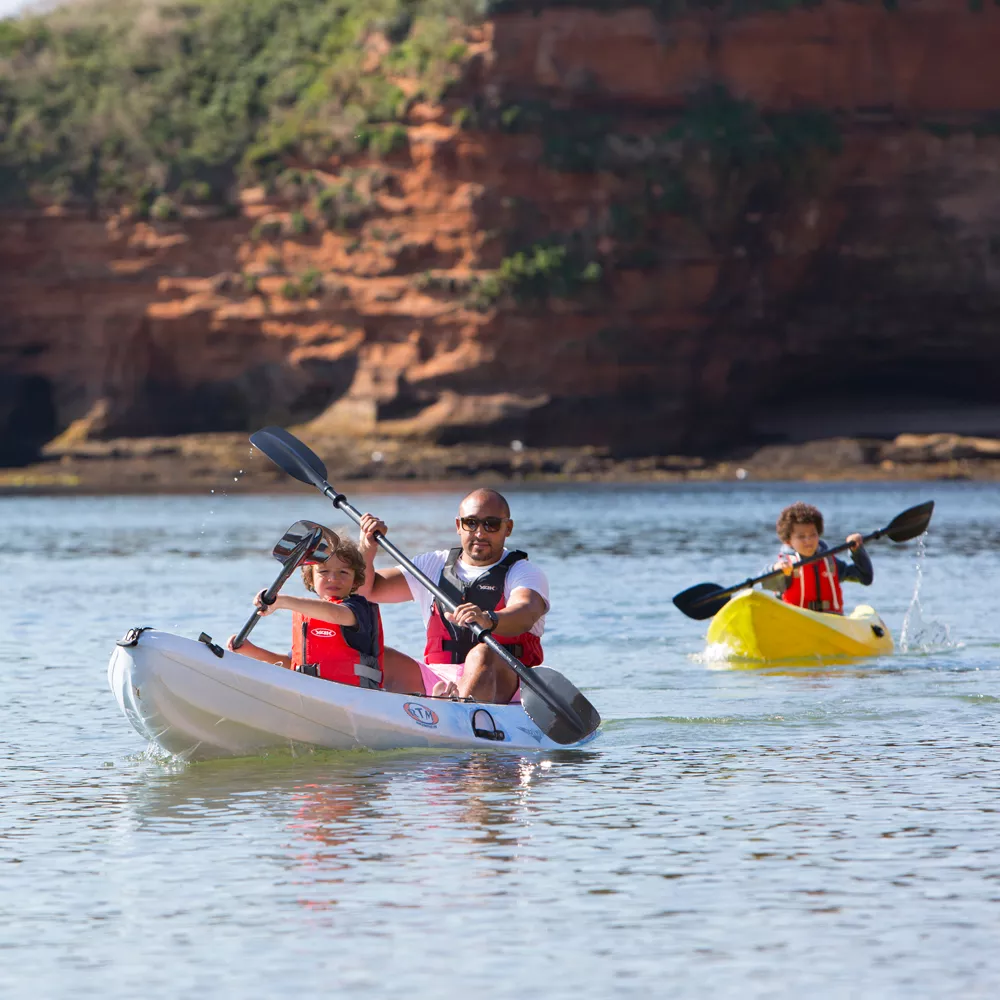
Kayak hire
Motor boat hire
Freshly caught seafood
Rockpooling at Ladram
Paddle board hire…
The relatively calm waters of the bay make Ladram an excellent place to try your hand (& balancing skills) at paddle boarding in East Devon. This activity is suitable for competent swimmers only.
Cost: Paddle boards can be hired directly on the beach & cost £15 for an hour.
Kayaking hire…
Our stunning stretch of Jurassic Coast is best appreciated from sea & we can think of few better (or more gratifying) ways to take in the scenery than paddling out on a kayak.
Cost: Single person kayaks can be hired on the beach & cost £12.50 per hour. Double kayaks cost £18 per hour.
Motor boat hire…
Whether your feeling like a lucky fisherman or want to take the children on a maritime adventure, Ladram Bay have motor boats for hire throughout the season. Please note boat hire is weather dependent.
Cost: Motor boats can be hired from the beach & cost £35 for 1 hour, £60 for 2 hours and £90 for 4 hours.
Freshly caught seafood…
Ladram Bay have several (very) seasoned fishermen & being situated by the ocean means we can offer some seriously fresh seafood for guests to cook up. If you are staying with us please ask a member of staff on the beach for quantities & availability – our fishermen might be good but they can’t predict what will be caught!
Rock pooling at Ladram
Ladram Bay provides the perfect rock pooling environment to bring out the zoologist in each of us & is best experienced when the weather is calm & dry as the rock pools will be still and therefore easier to spot creatures.
As rock pooling is one of our favourite things to do at Ladram check out our top tips on our dedicated blog post. Within our ‘guide to rock pooling in East Devon‘ we outline when to go, where to look & what you can expect to find.
If you’re lucky enough to find a pipefish, crab or starfish remember to return all creatures back to the area you found them.
Things to do on Ladram beach